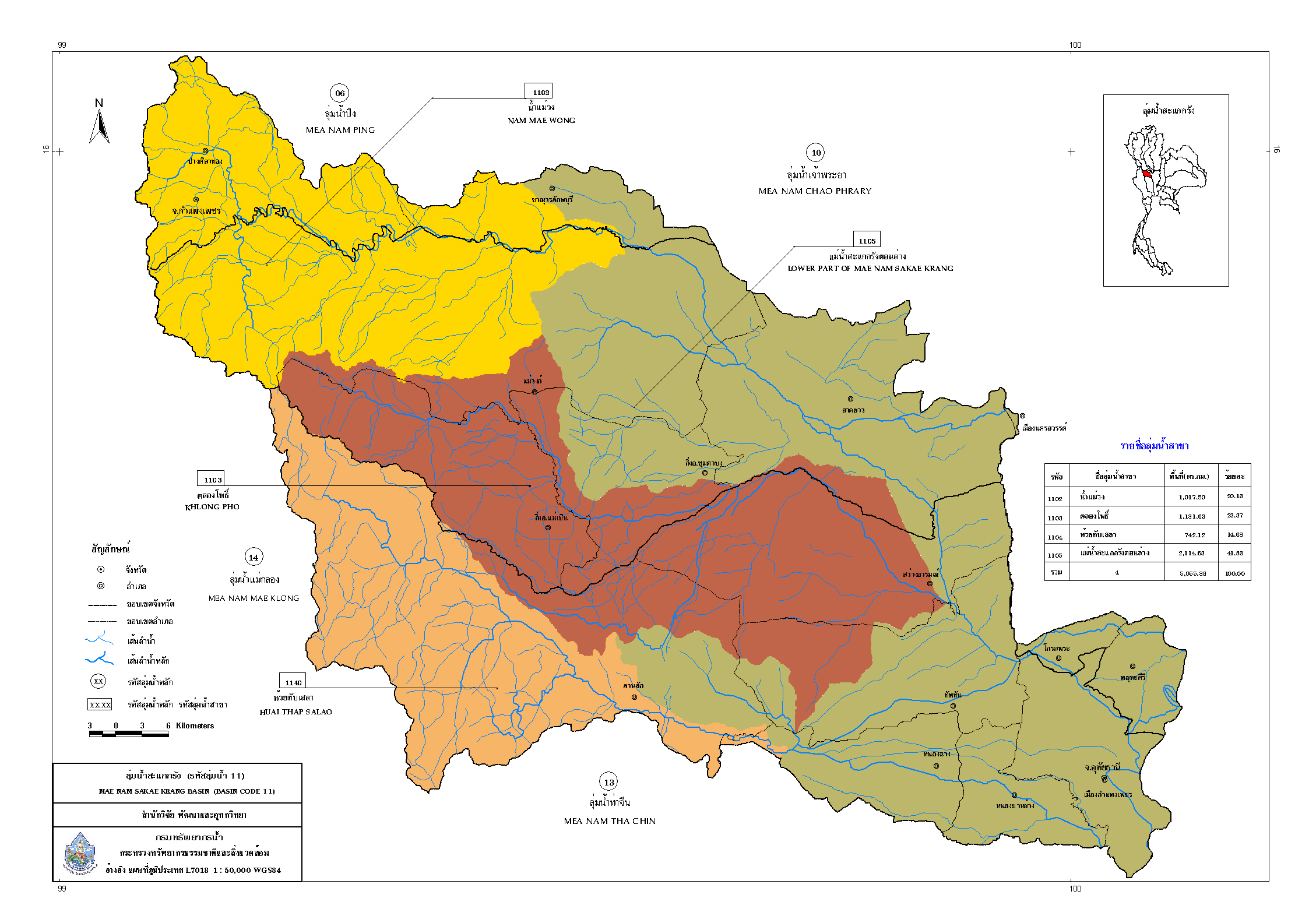
Basic information about the Sakae Krang River Basin.
Area conditions The Sakae Krang River Basin is located in the central part of Thailand. The total watershed area is 4,906.53 sq km, comprising four sub-basins: the Mae Wong River basin (1,031.54 sq km, 21.02%), the Khlong Pho River basin (1,174.09 sq km, 23.93%), the Huai Thap Salao River basin (755.24 sq km, 15.39%), and the Lower Sakae Krang River basin (1,945.66 sq km, 39.65%) (Department of Water Resources, 2011). The majority of the area covers three provinces: Kamphaeng Phet, Nakhon Sawan, and Uthai Thani. The western part of the basin consists of high mountain ranges and is the headwater of several important tributaries, including the Mae Wong River. The Huai Khlong Pho and Huai Thap Sala, the origins of the Sakae Krang River, are in the Mokochu mountain range, which forms the boundary between Tak and Nakhon Sawan provinces. The headwaters of these three tributaries are quite steep, gradually sloping down until they flow into the Chao Phraya River plains to the east of the basin. The tributary that is the source of the Sakae Krang River is Huai Mae Wong, which flows through Mae Wong and Lad Yao districts in Nakhon Sawan province. It joins Huai Khlong Pho, which flows from the mountain range dividing Nakhon Sawan and Uthai Thani provinces, becoming the Tak Daed River. This river then flows into Huai Thap Sala in Thap Than district, Uthai Thani province, before entering Nakhon Sawan city and flowing along the Sakae Krang mountain range, hence the name Sakae Krang River, before flowing into the Chao Phraya River north of the Chao Phraya Dam.
Topography The Sakae Krang River basin is oriented in a west-east direction, situated between latitudes 14° 25′ North and 15° 08′ North, and between longitudes 99° 05′ East and 100° 05′ East. Its boundaries are as follows:
To the north, it borders the Ping River basin.
To the south, it borders the Tha Chin River basin.
To the east, it borders the Chao Phraya River basin.
To the west, it borders the Mae Klong River basin.
The western part of the river basin consists of high mountain ranges and is the headwaters of tributaries. The land has a relatively steep slope, gradually draining down until it flows into the Chao Phraya River plains in the eastern part of the basin.
Sakae Krang River Basin