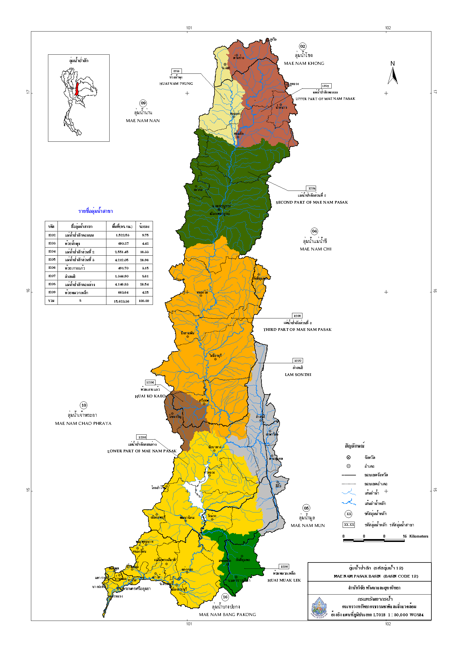
Basic information about the Pa Sak River Basin.
Area conditions The Pa Sak River Basin has a total drainage area of 15,625.87 square kilometers, comprising 8 sub-basins: the Upper Pa Sak River Basin (1,531.95 sq km, 9.80%), the Huai Nam Phung Sub-basin (681.43 sq km, 4.36%), the Pa Sak River Basin Part 2 (2,556.57 sq km, 16.36%), the Pa Sak River Basin Part 3 (4,207.29 sq km, 26.93%), the Huai Ko Kaeo Sub-basin (496.93 sq km, 3.18%), and the Lam Sonthi Sub-basin (1,336.95 sq km, 1,336.95 sq km, 1,531 ... The lower Pa Sak River basin covers an area of 4,149.66 sq km, representing 8.56%, while the Huai Muak Lek sub-basin covers 665.09 sq km, representing 4.26% (Department of Water Resources, 2011). It encompasses most of the provinces of Loei, Phetchabun, Chaiyaphum, Saraburi, Lopburi, Nakhon Ratchasima, and Phra Nakhon Si Ayutthaya. The Pa Sak River is the main river, originating in the upper mountain ranges of Loei province. It flows from north to south, passing through Phetchabun and Lopburi provinces, into the Pa Sak Chonlasit Dam, then through Saraburi province to the Rama VI Dam, and finally joining the Chao Phraya River in Phra Nakhon Si Ayutthaya province. Its total length is approximately 700 kilometers, with numerous tributaries branching off to the west and east. However, most tributaries are short and have small catchment areas.
Topography The Chao Pa Sak River Basin is oriented in a north-south direction, situated between latitudes 14° 15′ North and 16° 20′ North, and between longitudes 100° 30′ East and 101° 30′ East. Its boundaries are as follows:
To the north, it borders the Mekong River basin.
To the south, it borders the Bang Pakong River basin.
To the east, it borders the Chi River basin and the Mun River basin.
To the west, it borders the Chao Phraya River basin and the Nan River basin.
The upper part of the Pa Sak River basin is surrounded by the Phetchabun mountain range, and the land is generally characterized by hills with only small areas of plains. The central part, in Lopburi and Saraburi provinces, consists of plains interspersed with hills. The lower part of the basin, at its confluence with the Chao Phraya River in Ayutthaya province, is a lowland plain. Overall, the river basin is surrounded by mountains on both sides, with the Pa Sak River flowing through the center from north to south. Its origin is in the Phetchabun mountain range in Dan Sai district, located in southern Loei province, and it then flows through Phetchabun, Lopburi, and Saraburi provinces before joining the Chao Phraya River.
Pa Sak River Basin